When showing people around Rome I think it’s important to mention how we know what we do (& indeed whether that information can be trusted).
I can tell you that the Colosseum was inaugurated with 100 consecutive days of games, or that a 120 ft statue of the sun god known as the Colossus stood in front of it, or show you a reconstruction of the Temple of Julius Caesar in the Forum but – you may wonder, and in your shoes I would, and indeed have – how do you know that?
Sources are many and varied and one of the most useful things I was taught both at school and university was to question the source’s validity and accuracy. This skill is ever more important in the current age of the proliferation of unfiltered information (not least this blog). To quote a medieval source (Bede, Magister Gregorius) on the games at the Colosseum writing centuries after the last games were held is interesting but tells more of medieval perception of Ancient Rome than of actuality. Indeed it is sometimes posited that Bede, like so many guide book writers, never even visited Rome.
For a primary source on the inaugural games our thoughts more naturally turn to Martial, who was there. Yet, are we to believe every word of his colourful “Book of Shows”? Does the elephant which kneels before the Imperial box do so through the spontaneous perception of the Emperor’s supremacy? We can and should assume, therefore, a certain amount of spin and embellishment.
As well as literary sources, numismatics are an important clue to the forms of ancient buildings: if we can deduce from the pile of rubble in the centre of the Forum what the Temple of the Divine Julius Caesar once looked like it is thanks to coins commemorating its dedication.
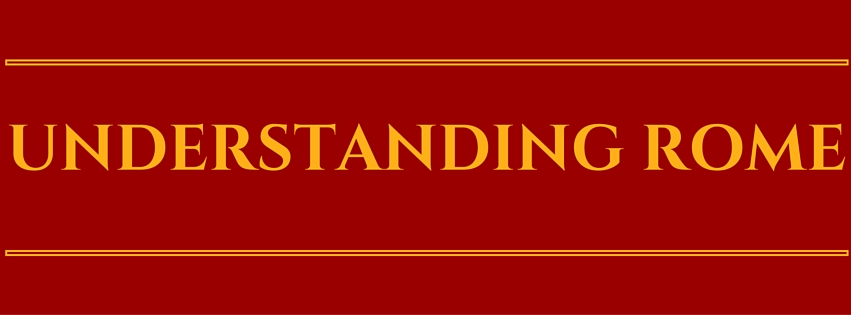
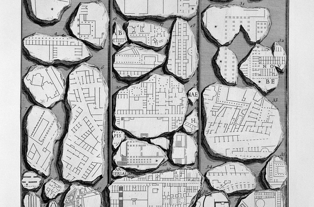
Fragments of the Forma Urbis, in an engraving by Giovanni Battista Piranesi (1756)
Another incredibly important source of information of the layout of Ancient Rome is the Forma Urbis, a map of the footprint of all of the buildings in the city dating to the reign of Septimus Severus (early 3rd century). Circa 18m by 13m, it was carved on 150 slabs of marble, and originally hung on the wall of the Temple of Peace (today the wall is part of the monastery of Sts Cosma and Damien). About 10% of the map survives in the archives of the Capitoline Museums.
The combination of the archeological remains, the Forma Urbis, & surviving literary sources provide a web of clues which can be pieced together to recreate the fabric of the city at various points in its slow rise and inexorable fall.
Recent Comments